Microsoft announces new partnerships and capabilities for Azure Space
2 min. read
Published on
Read our disclosure page to find out how can you help Windows Report sustain the editorial team. Read more
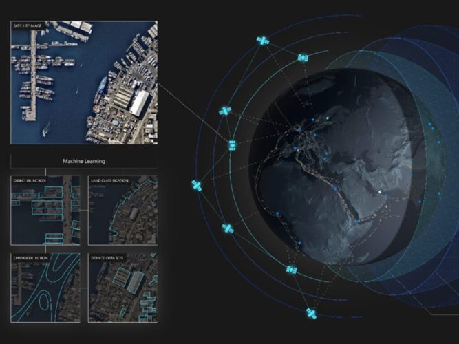
Microsoft has announced new capabilities and partnerships for Azure Space, the company’s cloud computing platform that connects satellites and services across industries. The company has also unveiled a new set of tools that should help to enhance satellite images.
First up, the Redmond giant has launched a new service called “Azure Orbital” in public preview, allowing customers to communicate and control satellites from ground stations. With this cloud-based ground station service, organizations can now securely and efficiently store, process, and analyze data in the cloud with reduced costs.
Microsoft also unveiled SpaceEye, an AI-powered tool that fetches cloud-free optical and multispectral satellite images of the Earth. “SpaceEye uses the Synthetic Aperture Radar (SAR) instrument from the Sentinel-1 mission as a baseline data source—as radar data is not affected by cloud cover. Space Eye then combines this radar data with historical optical imagery to generate an AI image prediction of what it looks under the clouds. This can unlock significant use cases in agriculture, land-use monitoring and disaster response among others,” explained Tom Keane CVP for Microsoft Azure.
Furthermore, Project Turing, which is built on Microsoft Azure, uses artificial intelligence to analyze and enhance the resolution of satellite images. The company highlights that the technology is already running on Azure to improve Bing Maps worldwide, which covers more than 50 percent of all user requests.
Microsoft also announced new partnerships with Airbus, Blackshark.ai, iDirect, Esri, as well as Orbital Insight. These partnerships will bring high-resolution satellite imagery, new data insights, and more flexible solutions to Microsoft’s Azure Space ecosystem. “The power of extracting and leveraging data collected from space can transform entire industries and create new paradigms,” Keane said yesterday.




User forum
0 messages